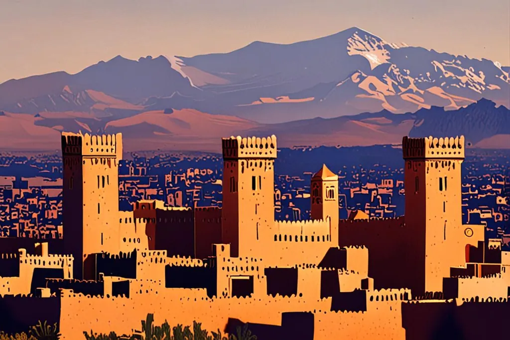
Ouarzazate stands at 1,151 metres on a bare plateau south of the High Atlas, where the road over the mountains meets the roads into the Draa valley and the desert. It has 79,218 people, a kasbah in the middle of town, and a film industry that has been shooting here since 1983.
It calls itself the door of the desert, and for once the nickname is exact. North of town the road climbs the Tizi n’Tichka into the mountains; south and east it flattens into a ribbon of oases and then sand. Almost everyone going one way or the other stops here, which is why a town of this size has hire cars, hotels, a cinema museum and an airport built for 260,000 passengers a year.
A town that is older than it looks
The name is older than the settlement. In Tachelhit it comes from a riverbed that widens after a narrow passage, where the sound of the water softens, and reading it as the quiet city is a later interpretation rather than the original one. For centuries this was a crossing place on the route that carried goods between the Sahara and the north, and the kasbah above the river belonged to an emir whose daughter married into the Saadian dynasty.
- People in the town, 2024
- 79,218
- Height above the sea
- 1,151 m
- From the centre to Atlas Studios
- 5 km
- The Tizi n’Tichka pass above it
- 2,205 m
The town you drive through now is much younger. Under the French protectorate Ouarzazate grew into a garrison town, an administrative centre and a customs post, and the church of Saint Therese was built in 1931. It is a provincial capital of the Draa-Tafilalet region, with a mellah that held about 170 Jewish residents in 1954 and a synagogue said to be nearly three hundred years old. West of town the Noor solar plant was connected to the national grid in 2016, and in November 2023 the town joined the UNESCO Creative Cities Network on the strength of its film work.
The kasbah in the middle of town
Kasbah Taourirt is the reason to give Ouarzazate an afternoon rather than a night. Oral tradition gives it to the Imzwarn family in the seventeenth century, and it was taken over and enlarged by the Glaoui family in the nineteenth, who controlled the meeting of the Draa and the Dadès valleys and the Saharan trade that ran through them. Thami El Glaoui, the pasha of Marrakesh for the whole of the French protectorate, came from that house, and the Krupp field gun parked outside the gate is a reminder of how the family kept its authority.
The building is rammed earth and mud brick, three storeys in places, with square towers at the corners and geometric motifs cut into the upper walls. Some rooms keep their tataoui ceilings, woven from reeds and slung between the beams. The unrestored part, the residence of Qa’id Hammadi, who held office from 1882 to 1939, carries carved stucco, wall paintings and arches borrowed from the imperial cities. The kasbah was added to the national heritage list in 1954, sold to the municipality in 1972 and then left alone until the late 1980s, when conservation work began; part of it was restored in the 1990s with UNESCO support and is open to visitors, while other rooms are still lived in. It has appeared in Gladiator and in Prince of Persia, which is a strange thing to be told while standing in a building that families still use.
Five dates in a town of film crews
16th century
A kasbah on the caravan road
An emir of the kasbah here, whose daughter married into the Saadian dynasty, helped bring the Sous and the Draa under Saadian control. The place was a crossing on the route that carried goods between the Sahara and the north.
1931
A garrison town under the protectorate
Ouarzazate grew into an administrative centre and a customs post under French rule, and the church of Saint Therese was built. The town you drive through today is mostly this one.
1983
Atlas Studios opens
A film studio was founded five kilometres west of the centre, on land that could pass for Tibet, Rome or Egypt. By area it is the largest in the world, and a second studio, CLA, was built in 2004.
2016
The solar plant joins the grid
The first part of the Noor solar plant, whose mirrors cover the plateau south west of town, was connected to the Moroccan grid in February, and the towers are now part of the drive south.
2023
An earthquake, and a creative city
The September earthquake cracked the kasbah and the historic quarter. In November the town joined the UNESCO Creative Cities Network, on the strength of the film work that had by then been going for forty years.
The studios, and what you can see of them
Atlas Studios opened in 1983 five kilometres west of the centre, and by land area it is the largest film studio in the world, which sounds more impressive than it is until you notice how much of that land is desert, mountain and standing sets. A second studio, CLA, followed in 2004. Twenty to fifty foreign productions shoot in the area in an average year, drawn by the light, the trained crews and a permit system that wastes nobody’s time, and Moroccan staff make up about eighty per cent of the people they employ.
Both studios take visitors. A tour of Atlas walks you through scenery that has been built for films and television you have probably seen: a Tibetan monastery beside a Roman arena beside an Egyptian temple. The Cinema Museum, opposite the kasbah, opened in 2007 in a former studio and holds sets, props, costumes and projection equipment. Neither takes more than an hour, and together they explain the town better than anything else you can do in an afternoon.
What kind of stop is Ouarzazate for you?
Are you driving through between Marrakesh and the desert?
Do you want to see how the films are made?
One night, on the way through
Arrive in the afternoon, walk the kasbah while the light is going, eat in the square and leave in the morning. Book the hotel before the pass, because the good rooms in town fill with crews and with groups on their way to the dunes.
Two nights, with a tour and the ksar
Give the town a full day: the kasbah and the Cinema Museum on one afternoon, a studio tour the next morning, and the drive west to Aït Benhaddou in between. Two nights here also mean you cross the Atlas in daylight in both directions.
An afternoon and the kasbah
Ouarzazate is small, and half a day covers the kasbah, the museum opposite it and a walk through the old mellah. If the studios hold no interest, this is the shape of the stop, and it leaves the evening for the road south towards the Draa.
Crossing the Atlas on the Tizi n’Tichka
Almost everyone comes in over the Tizi n’Tichka, the highest major pass in North Africa, which links the plain above Marrakesh to the south. The sign at the top says 2,260 metres, and a satellite reading in 2022 put the highest point of the road at 2,205. Snow falls on the pass from November through March, and it is cold up there at any time of year once the sun goes. The road was built along the old caravan trail by the French military in 1936 and is now part of National Route 9.
It is a long climb with a lot of bends and a queue behind the lorries, and it rewards patience rather than hurry. Fill the tank in Marrakesh, because the last stretch has nothing on it; allow three to four hours with a stop; and keep it out of your plans after dark in winter, when the surface and the visibility both change without much warning. The last wild Barbary lion recorded in Morocco was shot near this pass in 1942, which tells you how much wilder the mountain was not long ago.
South of town: the Draa, the oases and the sand
South east of Ouarzazate the road follows the Draa, Morocco’s longest river at about 1,100 kilometres. It is formed where the Dadès and the Imini meet, and it runs from the High Atlas towards the Atlantic. The El Mansour Eddahbi dam was built in 1971 to regulate it and to supply the town, and for most of the year the river below Tagounite is dry, which is why the valley reads as a green ribbon of palm rather than as a river.
The upper valley is about 200 kilometres of oases and their ksour: Mezguita, Tinzouline, Ternata with Zagora, Fezouata, Ktaoua and Mhamid el Ghuzlan at the end, the last village before the open sand, with two stretches of the river protected as Ramsar wetlands. The other road out of town runs north east towards the Dadès gorges, and the third goes west to the ksar at Aït Benhaddou. Whichever way you go, the first hour out of town is the one where you notice that nobody lives out there.
Arriving, and staying online
Ouarzazate airport is a small field at 1,153 metres with a single runway of 3,100 metres, an instrument landing system for the days when cloud sits on the plateau, and a terminal built for 260,000 passengers that handled about 53,000 in 2016. Royal Air Maroc Express flies to Casablanca and Zagora, Ryanair to Barcelona and Marseille, and Transavia to Paris Orly. Most visitors still arrive by road, over the pass.
Signal in town is good; the pass and the valley are not. The Tizi n’Tichka has long stretches with nothing on them at all, and the side roads into the oases are thinner still, so buy a plan before you leave Marrakesh or at the airport when you land rather than in the mountains. If you are weighing a local SIM against a travel eSIM for the trip, what a Moroccan SIM card involves sets out the paperwork and the cost.
When to go
Ouarzazate has a desert climate with a real winter. Average daily highs run from 17.3 degrees in January to 38.8 in July, the record high is 44 and the record low is minus 7, and snow falls in the town in some years. Rainfall is about 115 millimetres over eighteen wet days, most of it in February and March and again in the autumn, and the sun shines for roughly 3,467 hours a year, which is the light the studios came for.
That leaves two comfortable windows: March to May, and October to November. Midsummer works if the middle of the day belongs to a siesta, and winter is clear and cold, with the Atlas white above the roofs and the kasbah outlined against it.
Before you leave the town
0/8
Ouarzazate is easy to treat as a junction, and most people do. Give it a day and the junction turns out to be a place: a kasbah that was the centre of a family’s power over the whole south, an industry that turns desert into other countries, and a road south that has carried people and goods for longer than any of the walls standing beside it.