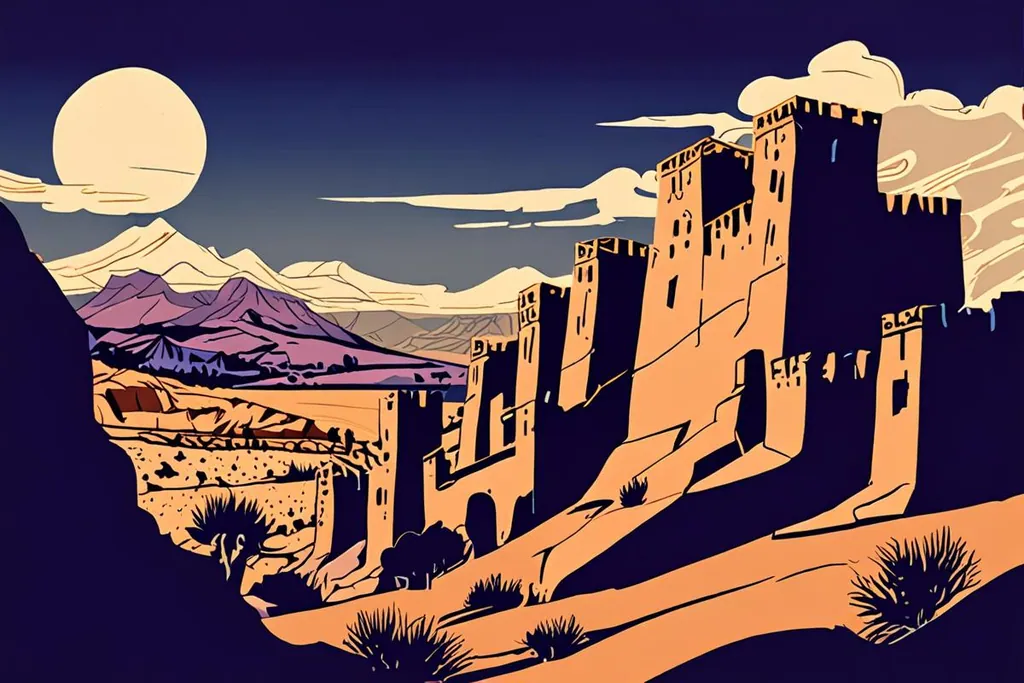
The Ounila river runs dry for most of the year, and the village sits on a hill above it because that is where water was low enough to cross and high enough to watch. For six hundred years this was a stopping point on the route that carried salt and gold and slaves over the Atlas to Marrakesh, and the ksar is what four centuries of that traffic built out of mud.
It is a strange thing to arrive at, because it looks like a film set and has in fact appeared in dozens of them, so the first instinct is to distrust it. Then you notice that the walls are eroding in the same places they would if nobody had invented cinema, and that there are laundry lines behind one of the doors, and the place settles into being what it is: a village people left and a handful came back to.
- Được UNESCO ghi nhận
- 1987
- Làng có tường thành
- 3 ha
- Phim và series quay ở đây
- 25+
- Độ cao của Ouarzazate
- 1,151 m
What you are actually looking at
The hill has been fortified since the eleventh century, during the Almoravid period, on one of the few passes between Marrakesh and the Sahara. Nothing standing today predates the seventeenth century, but the later builders used the same methods, which is why the whole village reads as one thing: buildings packed together inside a defensive wall with corner towers and a single gate, tall houses in the lower part with geometric patterns in the upper storeys, a mosque, a caravanserai for travellers, several kasbahs and the marabout of Sidi Ali or Amer.
At the top of the hill are the ruins of a large fortified granary, an agadir, which gives the language one of its most useful words: the same noun is behind the name of the city on the coast. There is a public square, a Muslim cemetery and a Jewish cemetery, the last of them a reminder that the villages of the south were mixed until the middle of the twentieth century, and outside the walls there is flat ground where grain was grown and threshed.
The material is the point. Everything here is rammed earth, adobe, clay brick and wood, mixed from earth and straw and compressed into formwork. It is cheap, it keeps a house cool, and it needs constant attention: a village of this type starts to crumble within decades of being abandoned. The taller buildings are rammed earth to the first floor and lighter adobe above, which is how the walls carry their own weight. UNESCO calls the result an authentic survival, and the reason it survived is that the repairs never stopped.
Năm mốc ở ksar
Thế kỷ 11
Pháo đài trên tuyến lạc đà
Ngọn đồi nhìn xuống sông Ounila được xây dựng kiên cố trong thời Almoravid, trên một trong số ít tuyến vượt qua Atlas giữa Marrakesh và Sahara. Nhiều kasbah và ksour khác cũng nằm dọc cung đường này.
Thế kỷ 17
Ngôi làng bạn nhìn thấy hiện nay
Không còn công trình nào cổ hơn thời kỳ này, dù kỹ thuật xây dựng và bố cục đều được kế thừa từ các thế kỷ trước. Đất nện, đất trộn rơm, gạch đất và gỗ, tu bổ thường xuyên.
1962
Lawrence of Arabia đến đây
Ksar bắt đầu xuất hiện trên phim từ thời David Lean, và kể từ đó các đoàn phim nối tiếp đến, phần nào đem lại nguồn lực để duy trì những bức tường này.
1987
UNESCO công nhận ksar
Ngôi làng kiên cố này được ghi danh nhờ kiến trúc đất và sự bảo tồn lối sống truyền thống, và nhờ đó nơi đây nhận được sự chú ý và hỗ trợ khi nhiều người dần rời bỏ làng.
2023
Động đất làm nứt tường
Trận động đất ở High Atlas tháng 9 năm 2023 làm hư hại ksar, với các vết nứt và sập một phần, nguy cơ hư hại thêm. Việc sửa tường đất cần cả thời gian lẫn thợ lành nghề.
Ouarzazate, and the studios next door
Ouarzazate is a provincial capital of about 79,000 people at 1,151 metres, on a bare plateau south of the High Atlas, and it calls itself the door of the desert because that is exactly what it is: the last town before the Draa valley and the sand. It has its own earthen monument, the Kasbah Taourirt, built of rammed earth and expanded by the Glaoui family, who ran the south for the French and kept a field gun outside the door to make the point.
The film industry arrived in the 1980s and never left. Atlas Studios was founded in 1983 and claims the largest land area of any studio in the world; a second, CLA, followed in 2004. Between twenty and fifty foreign productions shoot here in an average year, drawn by desert, mountains, kasbahs, trained crews and a permit process that does not waste anyone’s time. The Cinema Museum, opposite the kasbah, is small and cheerful and shows what has been made and left behind.
Getting there: the pass and the valley
Almost everybody comes by road over the Tizi n’Tichka, the high pass that carries the main road from Marrakesh to the south. It is a long climb with a lot of bends and a queue behind the lorries, and it is the drive where you first understand how completely the Atlas separates two countries. Coming from Marrakesh it is a full day with a stop at the ksar; coming from Ouarzazate it is a short run west.
The other approach is the old caravan route itself, along the Ounila valley through Telouet, past the ruins of the Glaoui palace. It is slower and rougher and much better, with the villages of Tamdaght and others along the way, and if you have a car and a day to spare it is the way to come. Coaches run day trips from Marrakesh, which means six hours in a seat for three hours on the ground, and it is worth staying a night instead.
When to go
Ouarzazate has a desert climate with a real winter. Average daily highs run from 17 degrees in January to 38.8 in July, and the rainfall is about 115 millimetres a year with a handful of wet days in winter and almost nothing between June and September. The mornings in January can be close to freezing, snow sometimes falls in the town, and summer afternoons are as hot as the numbers suggest, so the walking day shifts to early morning and evening.
That leaves two comfortable windows: March to May, when the valley is warm and the light is long, and October to November, when the heat has gone but the sky is still clear. Summer is survivable if you plan around the middle of the day, and winter is beautiful and cold, with the Atlas white above the village and the kasbahs outlined against it.
Trước khi bạn lên đường
0/8
Aït Benhaddou is worth the long drive for itself, but it pays a dividend: it teaches you to look at earthen walls, and after that every kasbah, ksar and village along the southern valleys stops being a backdrop and starts being a piece of engineering you can read.